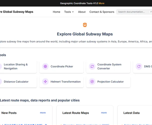
Explore Global Subway Maps
MetroLineHub is a pioneering website dedicated to providing comprehensive, interactive subway maps and travel tools for urban transit systems worldwide. Covering 300+ cities across Asia, Europe, the Americas, Africa, and Oceania , it serves as an indispensable resource for travelers, geospatial professionals, and public transport enthusiasts.
Visit WebsiteIntroduction
Core Features & Global Coverage
- Interactive Subway Maps
- Global Reach: Access high-resolution, multilingual maps (e.g., Tokyo Metro, London Underground, New York Subway) with real-time updates on routes, transfers, and station details
- Authoritative Data: All maps are sourced from official transit authorities (e.g., Beijing Metro 2025, Chicago Red Line) and include operational schedules, passenger flow trends, and new line openings
- Regional Highlights:
- Asia: Tokyo, Delhi, Singapore, Seoul - Europe: Paris Metro, Moscow Metro, Berlin U-Bahn - Americas: NYC Subway, Mexico City Metro, São Paulo Metro 2. Smart Travel Planning Tools
- Location Sharing & Navigation: Plot start/end points to generate optimal routes and share trip links
- Real-Time Schedules: Integrated timetables (e.g., Chengdu Metro 2025) with first/last train alerts to avoid missed connections
- Complex Transfer Guidance: 3D visualizations for major hubs like Shinjuku Station (Tokyo) or Zócalo (Mexico City)
Featured Products

Free Minigames Online
Play games in your browser, no downloads or installations required.
Learn More